

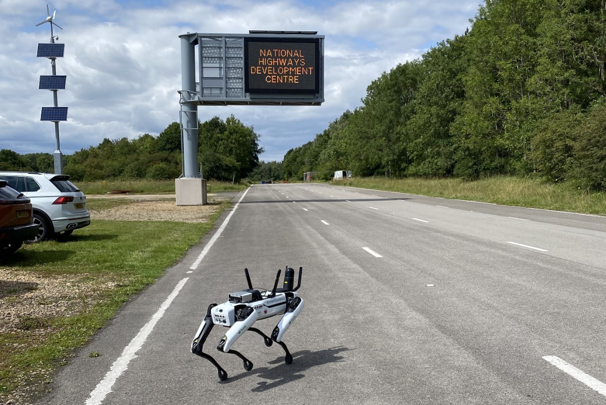
Boston Dynamics’ autonomous robot dog is being trialled by National Highways, BAM Ritchies and AECOM as part of geotechnical surveys in the south west of the UK.
The move has been done to inform forthcoming operational work with the robotic dog’s eye view employed to capture data remotely in difficult-to-reach locations, such as steep-sided embankments and natural slopes.
The use of the autonomous survey platform provides a safer and cost-effective option where inaccessible areas present difficulties and challenges to geotechnical inspectors.
The robot has also used at National Highways’ Development Centre at Moreton-in-Marsh last summer, where its capabilities were tested over a number of highways settings.
The four-legged robot has been employed in its first ‘live trial’ alongside the M5 in Somerset, using cameras and a Leica lidar tracker.
Guy Swains, Engineering Manager within National Highways’ South West Geotechnical team, said: “The initial, ‘proof of concept’ testing has been encouraging and we’re now live trialling the robotic tool with a view to utilising it via our contractors in future survey work, particularly in locations which present challenges for our traditional methods.
“Our structures team are currently working on renewing certain elements of the St Georges railway bridge between junctions 20 and 21 of the M5, and identified a number of geotechnical defects in the ground surface.
“The data from the trials will also be captured and analysed and dependent on results, hopefully we’ll be able to measure an improvement in safety methods and efficiencies and employ the technology in our future work.”
Matt Ewing, BAM Ritchies’ Business Development Manager, said: “Technology can keep our people safe and repeatedly capture high quality data, and having Spot undertake these trials demonstrates capability and evidence for further trials while making efficiencies in the delivery of work today.
“It’s about finding the right applications, and the team is focused on realising Spot’s potential.”
James Codd, AECOM’s Associate Director of Ground Engineering, said: “It’s a significant step, and could complement the existing geotechnical asset management and inspection processes, to improve the safety of inspectors and reduce the impact of their activities on people’s journeys.
The trials follow several National Highways’ research and development projects, led by the ARUP/AECOM consortium, which have been seeking to better integrate remote survey techniques into geotechnical asset management practice.
Image courtesy of National Highways